Threatened Areas
The original government master plan from 2002 envisioned the harnessing of every glacial river and every geothermal area in Iceland. When the current government came to power, they claimed they would not follow the heavy industry agenda of their predecessors. In reality, the heavy industry agenda is still being pursued and most rivers and geothermal areas are still under threat.
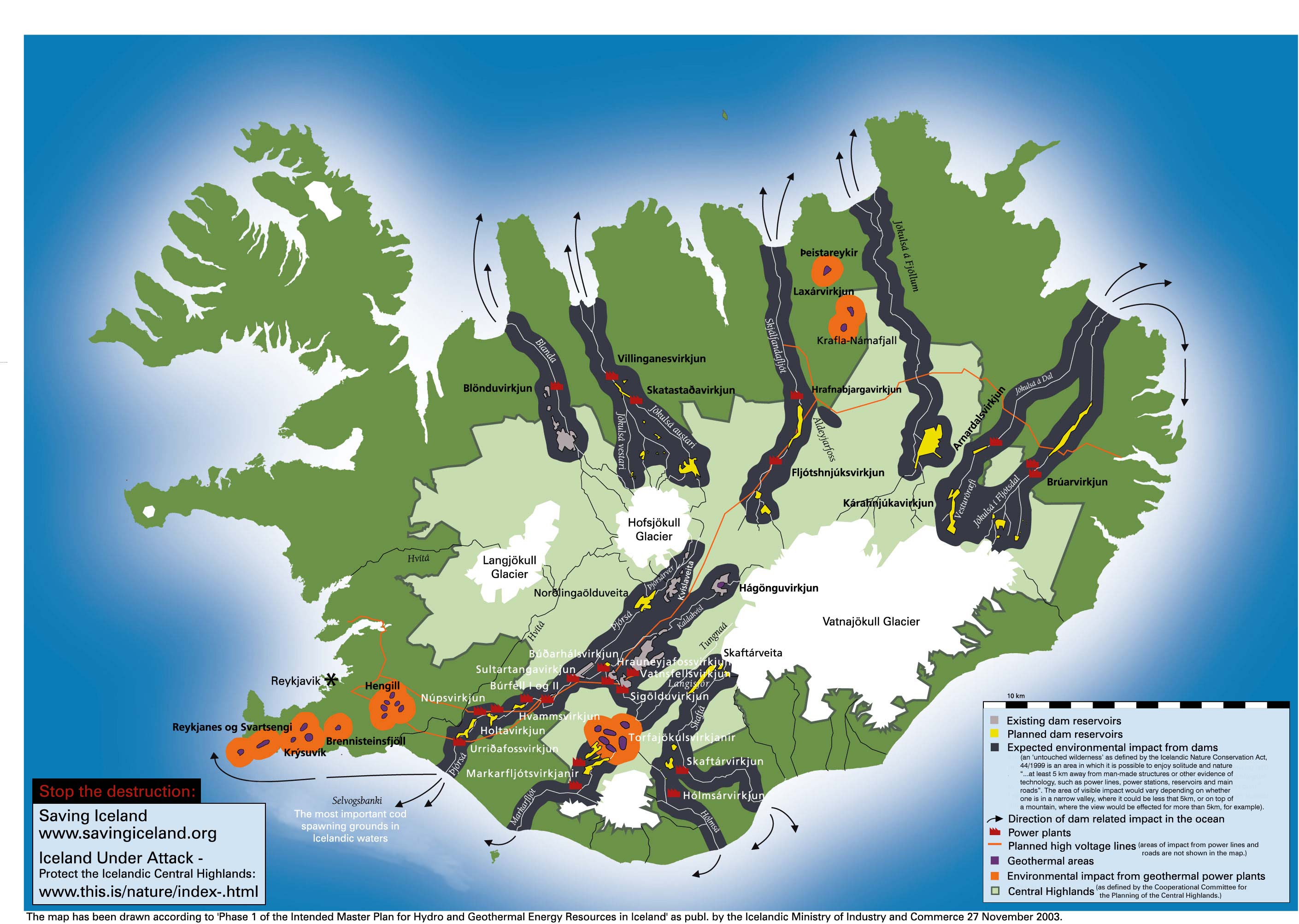
This map details the effects of planned dams, reservoirs and geothermal exploitation as well as the planned heavy industry projects. Click to enlarge.

- Map of the the master plan for energy production in Iceland (or text version)
- Power plant schemes for hydro and geothermal energy resources in Iceland
Read through the sections below for details on each of the threatened areas.
This page has the following sub pages.
- Hengill
- Farið
- Þjórsá, Tungnaá and Köldukvísl rivers
- Langisjór
- Thjórsárver
- Skjálfandafljót
- Skagafjördur, Vesturdalur and Austurdalur
- Jökulsá á Fjöllum
- Eyjabakkar
- Kerlingarfjöll
- Brennisteinsfjöll and Krýsuvík